
Welcome to Folkan Eye Technology
Eye in the sky and underneath to accurately identify minerals underground-anywhere worldwide.
is an international exploration and mining, based in Nigeria with assets in Nigeria and operations and projects in Ukraine, Spain, Estonia, Africa, America etc.
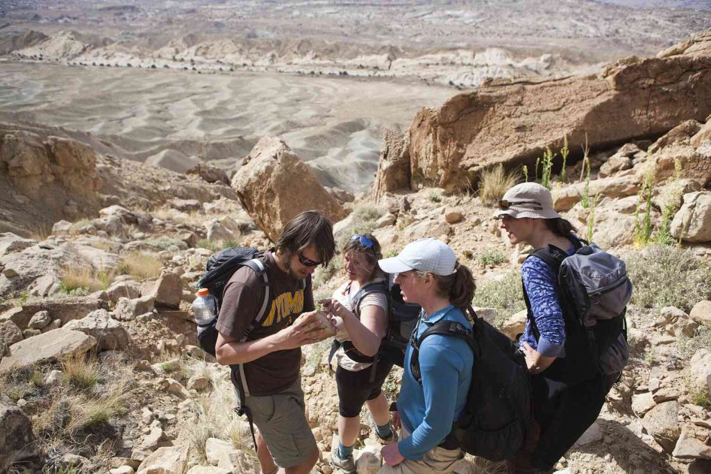
Folkan Eye Technology Limited (FET) operation cuts across geographical barriers worldwide.
Folkan Eye Technology Limited (FET) is inviting mining infrastructural investor-partners in developing the following recently acquired exploration and mining licenses in Nigeria:
FOLKAN EYE TECHNOLOGY Nig. Ltd. has acquired the following mining licenses in NIGERIA.
Lithium, Mica, Quartz : Is Located at Bauchi State Bauchi Local Government Miri Kundun Durum 4 Cadastral Units.
Amethyst : Is Located at Bauchi State Tafawa Balewa Local Government Bununu Bar Gyital Village 4 Cadastral Units.
Rose Quartz, Graphite : Is Located at Bauchi State Bauchi Local Government Yar Borno Village 4 Cadastral Units.
Iron Ore : Is Located at Bauchi State Bauchi Local Government Dandango Ju Village 91 Cadastral Units.
Tourmaline,Beryl,Feldspar,Lithium : Is Located at Bauchi State Toro Local Government Rauta Geji Felu Village 13 Cadastral Units.
Tin/Amethysts : Is Located at Bauchi State Misau Local Government Waliya Makaurachi Village 100 Cadastral Units.
Lithium,Quartz, : Is Located at Adamawa State Ganye Local Government Yebbi Konage Village 104 Cadastral Units.
Iron Ore : Is Located at Bauchi State Bauchi Local Government Dandango Ju Village 91 Cadastral Units.
Folkan Eye Technology Limited (FET) has recorded, 60+ successful projects all over the world, 50+ highly experienced team members, Eco friendly approach, has also operated in hard geographical conditions. Our technology will survey up to 5000 meters depth, and will provide our client with 95%+accuracy and efficiency.
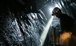
Folkan Eye Technology mining process:
Let’s explore, mine and leverage dormant assets to fund infrastructural development in Africa.
Contact us.
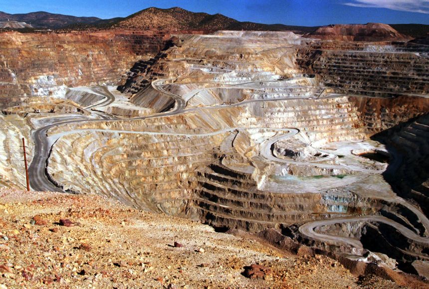
Gold mining is the extraction of gold by mining. Historically, mining gold from alluvial deposits used manual separation processes, such as gold panning. The expansion of gold mining to ores that are not on the surface has led to more complex extraction processes such as pit mining and gold cyanidation.
Silver mining is the extraction of silver from minerals, starting with mining. Because silver is often found in intimate combination with other metals, its extraction requires elaborate technologies.
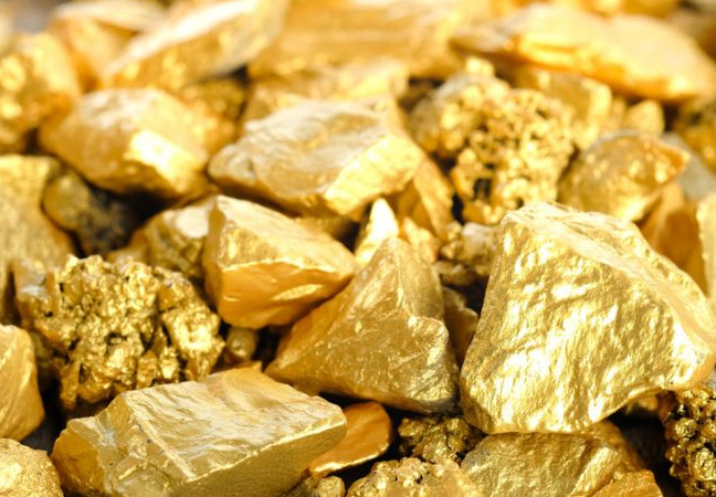
Gold
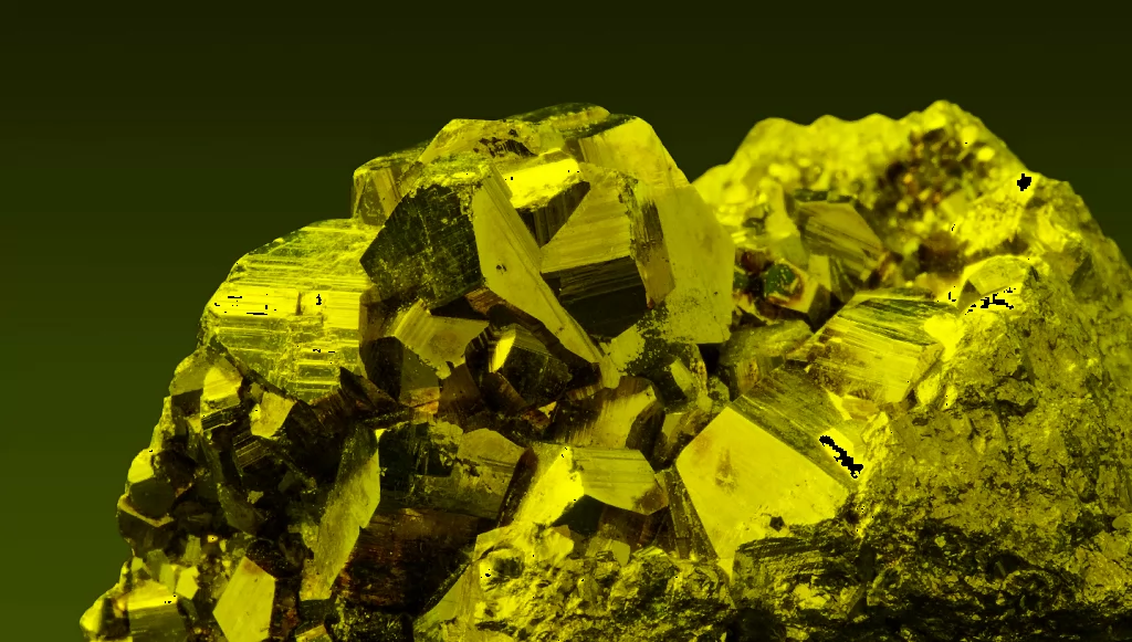
Silver
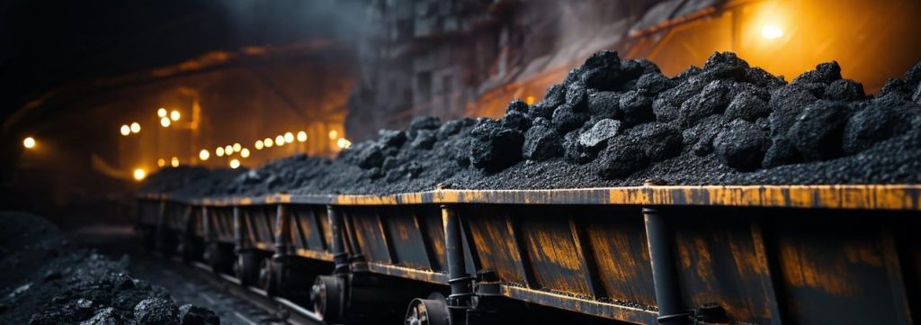
Coal
Coal mining is the process of extracting coal from the ground or from a mine coal from the ground or from a mine. Coal is valued for its energy content and since the 1880s has been widely used to generate electricity. Steel and cement industries use coal as a fuel for extraction of iron from iron ore and for cement production.
Our Mining Process:
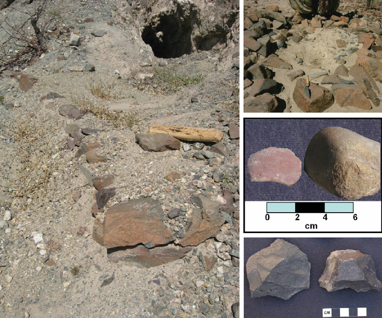
We offer a great mineral identification technology that is not limited to metal metals, coal, oil shale, gemstone, chalk, dimension stone, rock salt, potash, gravel, but includes underground water and oil reserves and others…
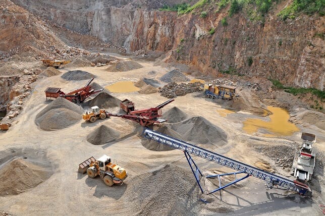
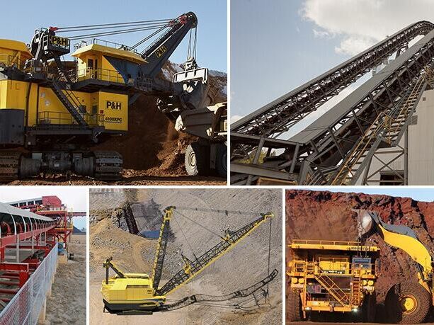
Our Mining Technology and Equipment
Our team are well equipped with technology and equipment required to accomplish any exploitations and mining of natural resources…

We are open for exploration and undiscovered underground treasures and mining contracts.
How the technology was born.
My friend Mr. Sergey Nikolaevich Azyukovsky had been working for 15 years as the general director of a military machine-building plant.
After he was in charge of all machine-building plants in Ukraine.
Then he was appointed as a head of the state company “Pivnichgeologia” (belongs to the State Service of geology and subsoil of Ukraine).
He studied out geology and applied completely new methods of minerals exploration. It brought together engineers from the space and nuclear industry, physicists, chemists, mathematicians and geologists into one team. This team includes 52 specialists who operate at the atomic level with analog infrared pictures.
For example, engineers from Skolkovo (Russia) are still behind for decades, because they work with digital pictures at the molecular level.
The history of technology.
The technology was patented in Germany (we didn’t extend validity of patents because it is expensive). The technology was tested in the USA.
We have already performed about 70 works in the world.
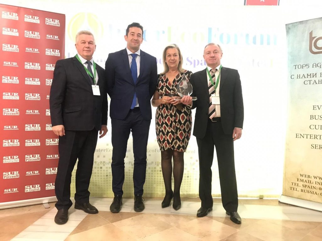
In 2019 we received the First Prize for the best technology for fresh water exploration in Spain at InterEcoForum (www.interecoforum.org ).
What it can do
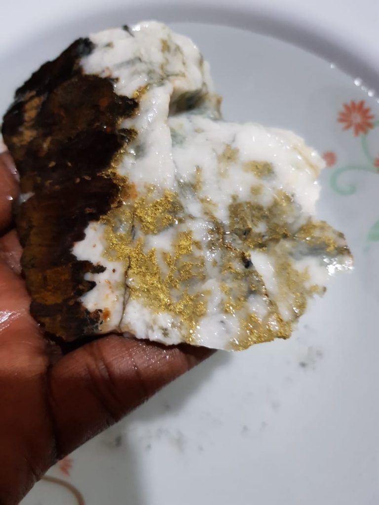
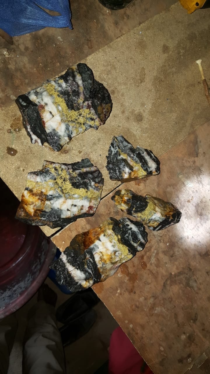
“See” fresh water, gas, oil, lithium, gold, diamonds and all other solid metals to a depth up to 5000 meters.
Also it can “see” field’s contours, layers, reserves, occurrence depths, segmentation points and best sites for drilling.
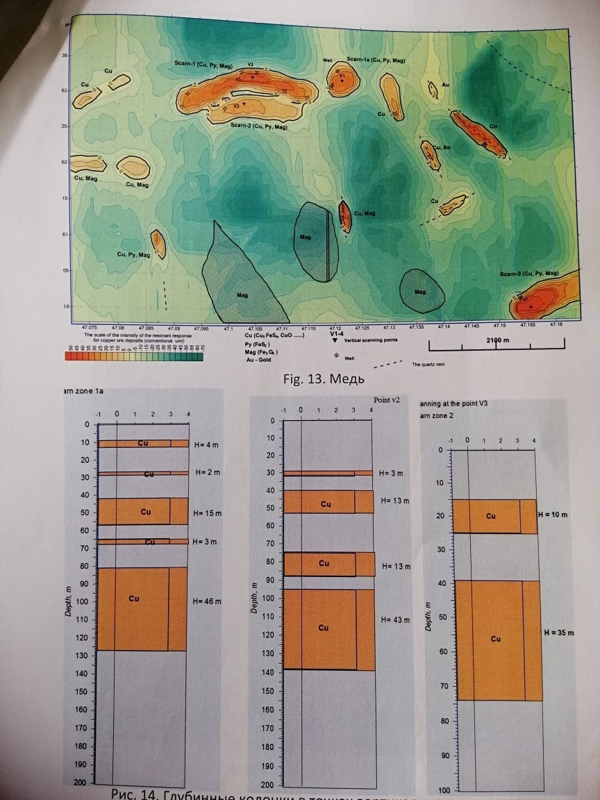
For example: Kazakhstan. The depth is 5000 m. Gas condensate. The channel with a diameter of 50-60 meters. The pressure is 400 atmospheres and goes deep into the earth.
The pressure in the cap of the field is 160 atmospheres.
This technology is very necessary. It gives opportunity to “see” oil and gas in offshore fields in hard-to-reach areas.
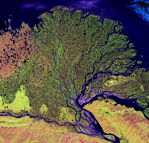
It “sees” all the water streams underground, which looks like a tree with branches.
In the earth’s crust it “sees” about 16 large “boilers” at deep depths.
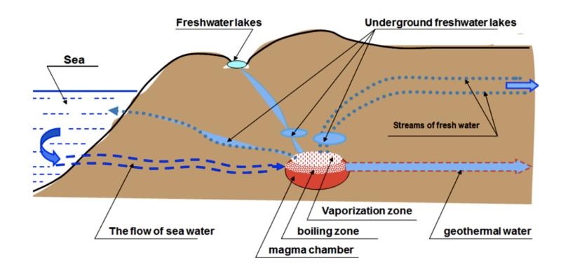
For example: Namibia. Ocean water gets into a split in a volcanic vent and after it contacts with a temperature of 2 000 – 2 500 degrees. Turns into steam and accelerates under the earth’s crust, absorbing all the elements useful for humans on the way and turns into underground rivers and lakes.
This place contains 30 times more water than on the land of rivers and lakes.
Our Technology can survey 50 000 square km per one month; it can survey 600 000 square km during one year.
It takes over 50 years for any other company in the world.
Who needs technology
The President of any country. The technology will make an underground map of all fresh water deposits and will indicate temperatures for 4th generation thermal power plants.
The President must provide future generation with:
A) pure fresh water, agriculture, livestock rearing, plants and forest (including fire extinguishing system).
B) clean and reliable energy.
Thermal power plants of the fourth generation.
For example:
An energy source with a temperature of + 360 degrees is taken from a depth of 4200m.
The capacity of plant is 100 megawatts, it costs USD 150 mln.
Each village, city has its own station.
Cost of operation makes 1 cent – 1 kW.
No power line needed. Ecology.
C) Financial safety bag.
The technology is looking for gold in the country of the president and in other countries. The Ministry of Finance finances the exploration, mining, and construction of refineries.
Gold is stored for future generations.
For Investor.
For example, Ukraine:
Native copper deposits in the amount of 1 million MT. An investor from his parent company invests USD 5 mln into exploration, pilot mining. After we approve the reserves of 1 million MT and form a set of documents according to the international standards.
Additionally, we order the feasibility study from the British company McLellan. The period of this stage is one year.
After registration, the entire set of documents will cost 10% of the total amount of copper sold during 10 years.
1 mln X 6000 = 6 bln USD
10% of USD 6 bln = USD 600 mln.
Building a mine costs USD 150 mln. After we can move forfard with extraction and production.
For example:
Ukraine. Gold deposits with reserves of 83 MT.
Ukraine. Lithium deposits 1 million MT.
1 million MT is 100 million lithium batteries for Tesla cars of Elon Musk company.
paperwork and formation of the set of documents on deposits – USD 5 mln.
Who doesn’t need our technology
Classical geological exploration. It is 70 years old. With the classical method you can explore an area for 4 years. Large companies spend USD 50 000 per square km. We do the work for 1-2 months, while the cost price even in hard-to-reach areas and on shelf is only USD 2000 per sq km.
Other companies need a lot of workers and equipment.
Our recommendation. Such companies need firstly to study the area with our technology, and then validate the reserves and confirm our results using classical methods. It will be cheaper, faster and 100% more accurate.
How our technology woks technically and financially
- You give the coordinates of the area and tell which material we need to find.
- Our engineers indicate the contours of the area according to your coordinates.
- We coordinate it with you.
- We define its value in USD.
- We give them the application for filling task assignment and the draft contract.
- We agree and sign.
- You pay 100% of the contract value. There were examples when it was necessary to divide the contract into two parts. At the beginning we explored fresh water in a large area, and then we did precise work for efficiency.
- After receiving payment, we buy from NASA analog pictures of the area according to your coordinates in infrared radiation.
- Chemists apply the chemical composition of the material on the gel plate.
- We add x-ray film.
- We put all this under the irradiation of a nuclear reactor.
- Further, physicists, chemists, mathematicians, geologists are engaged in decoding the obtained results.
- After one or two months, we send the report to the customer on a USB flash drive and we provide one hard copy of the report.
- We provide full confidentiality. Only the customer has a report.
- We go to the first drilling site to check the GPS coordinates and drilling points.
- building a mine – USD 150 mln.
- mining lithium – 10 years
- building a factory for the production of lithium batteries
- selling 100 mln lithium batteries for USD 600 bln.
Good business!
Spain. 500 square km between Malaga and Cordoba.
We need to get fresh water. Required financing – 2 mln euros.
We explore with new technology. Find water streams. We connect the underground water map with administrative map and we see where people need water supply.
We indicate drilling points from 150 to 1000 m.
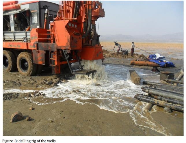
We drill about 20 wells.
Cities and towns, olive groves, pig farms and water users’ cooperatives sign a contract for the purchase of water for 25 years. Payback period is 1 year.
- Our engineers indicate the contours of the area according to your coordinates.
- We coordinate it with you.
- We define its value in USD.
- We give them the application for filling task assignment and the draft contract.
- We agree and sign.
- You pay 100% of the contract value. There were examples when it was necessary to divide the contract into two parts. At the beginning we explored fresh water in a large area, and then we did precise work for efficiency.
- After receiving payment, we buy from NASA analog pictures of the area according to your coordinates in infrared radiation.
- Chemists apply the chemical composition of the material on the gel plate.
- We add x-ray film.
- We put all this under the irradiation of a nuclear reactor.
- Further, physicists, chemists, mathematicians, geologists are engaged in decoding the obtained results.
- After one or two months, we send the report to the customer on a USB flash drive and we provide one hard copy of the report.
- We provide full confidentiality. Only the customer has a report.
- We go to the first drilling site to check the GPS coordinates and drilling points.
Technology Perspective
- Negotiations are underway with the UAE leadership to announce our technology at EXPO 2020 in Dubai.
- We were invited to visit the Nobel Committee in Sweden in 2020.
- Our engineers already know how to determine the temperature of the earth at a depth of 10000 meters
- We plan with future investors to incorporate the parent company named “Space Nadra” in any country, and open its 100% subsidiary company in Ukraine. Buy a building from the State Property Fund of Ukraine with 8000 square m for USD 8 mln. Gather all scientists and engineers there. After we would like to agree with the investor for the selection of 100 young specialists to work in Kyiv (Ukraine). Each scientist has 2 young specialists for training. In two years they will learn this technology. This way we will preserve the technology and develop it further.
Petr Zinchenko.
zpp1972@gmail.com
+380958704603.

Signed a contract in Barcelona. Looking for oil and gas in Argentina.
New technology for the exploration of minerals, fresh water, and geothermal energy continues to be developed. We had an order to explore ALL minerals on the territory of Djibouti. Nobody in the world has done such work. This work involves the detection of Anomalous Zones, for the fast and accurate determination of mineral deposits. Also this work foresees the creation of 4 maps.
- Map of the country’s gravity anomalies.
- Map of regional gravity anomalies with geo-reference to the area.
- Map of magnetic anomalies.
- Topographic map of the entire territory of the state, with contours of 3 combined mentioned above anomalies on it (with indication of the exact coordinates of all anomalies). The anomaly indicates 100% presence of minerals within it area. This approach allows you to reduce up to 70% of empty areas. Also it reduces the cost of prospecting and exploration works to high extant!
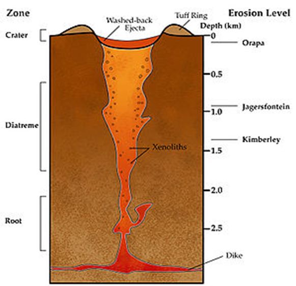
Some thoughts about how we can start our work. To start a project for the extraction of gem diamonds, you need to do following:
1. Determine the coordinates and area of the site in………………………… 2000 km sq. Explore this area from space. At this stage we will look for Kimberlite pipes. This work will cost 250.000 USD. We will find 10 pipes.
2. An area of 5-6 km sq will remain. After we will find approximately 5 pipes with Pyrope (garnet stone) Cost 60.000 USD. 3. We will split 5 tubes into Technical and Jewelry diamonds. Approximately 2 tubes with gem diamonds remain. Cost 30.000 USD.
4. In 2 jewelry tubes, we determine the contour. Depth of horizons. Opening. The concentration of jewelry diamonds. Reserves of diamonds. Cost 60.000 USD.
- All works will cost 400.000 USD. Working time 1.5-2 months.
Hello. How do people live with fresh water in your countries? The thing is, our 52 engineers have developed a new technology. It involves probing the ground using magnetic-nuclear resonance. This technology can see everything, underground, up to a depth of 5000 meters. It’s 50 times faster and 25 times cheaper. There’s a lot of fresh water underground. It originates from the ocean, flowing underground into volcanoes and volcanic calderas. While exploring for minerals in different countries, we’ve come across 16 volcanic calderas, the largest being in Namibia. In the volcano, ocean water evaporates and then transforms into droplets and fresh water. These water droplets form streams and rivers, eventually turning into waterways. These waterways have been flowing for thousands of years, covering thousands of kilometers. They won’t run out.
Many people lack information and confuse underground water sources. Traditional geological surveys identify surface waters (0-150 meters). Our new technology can detect water sources from 150 meters and below. In the first stage, you can provide the initial 500 square kilometers (similar to Spain, where water is scarce). We’ll find water at depths of approximately 300-600 meters. We’ll provide drilling points and connect them with points of fresh water consumption.
In the second stage, we’ll find a company for drilling water wells in any country. We’ll oversee the drilling process to prevent low-quality water from upper layers reaching lower layers. One well can provide 10 liters in 1 second. Think carefully. People will drink it. Animals. Plants. God has given you plenty of fresh water and geothermal energy underground! We can create an underground map of any country up to a depth of 5000 meters. Four maps. 1. Freshwater streams. 2. Geothermal energy (faults + hot water + hot rocks. Water, energy, and heat in every home). 3. Solid useful minerals. Gold. Diamonds. Copper. Uranium. (Build new mines and plants.) 4. Hydrocarbons. You should know about all the oil and gas, and gas condensate. Know the reserves.
This is a new technology. It will be four maps on your desk. And you will provide a new development strategy to your people for the next 50 years.
How the tecFederal Republic of Nigeria. Water Program – EYES UNDERGROUND. Technology was born.
Recent studies have allowed the distinction of the birth and movement of underground water flows based on their depth. Classical geological surveys could previously detect surface water flows at depths ranging from 0 to 150 meters. These had low flow rates and were dependent on rainfall, climate, and drought conditions, resulting in poor quality water. However, with Ground Magnetic Resonance Scanning, engineers from the Federal Republic of Nigeria, in collaboration with engineers from the United States, Tallinn Polytechnic Institute, and Ukraine, have identified 16 underground volcanic hot springs at various depths. The largest one was found in Namibia.
Studies have revealed strong movements of oceanic water flows into underground volcanic hot springs. When ocean water enters an underground volcano, it rapidly evaporates and transforms into steam. This steam condenses into drops of fresh water and, through fissures in the Earth’s crust, becomes streams and rivers. These formed water flows travel thousands of kilometers and last for thousands of years, representing the natural cycle of underground water.
For the Federal Republic of Nigeria, the EYES UNDERGROUND water program opens new possibilities for providing fresh water to the country’s residents, animals, birds, and plants. In the initial stage, there is a proposal to create an underground map of all water flows within the territory of the Federal Republic of Nigeria at depths of 150 meters and below. This will allow the determination of flow rates, depth, consumption points, and drilling locations. In the second stage, companies for drilling water wells will be selected in each region. The initial broad boreholes will be cemented to the depth of the consumed water flow, and then production wells will be drilled within them. This approach will prevent future contamination from surface water flows at depths from 0 to 150 meters. The depth of the production well will influence the power of the pumping equipment and its cost. In the absence of electricity supply, a specialized container powered by solar panels, equipped with pumping devices from the Republic of Bulgaria, will be installed.
Water Program – EYES UNDERGROUND. For any country. This new technology was first published in the European Geological Journal Copernicus in 2016. It has observed the birth and movement of all underground water streams at depths of up to 5000 meters. 50 times faster than traditional methods. The question arises: How many years have classical geological surveys and seismic techniques been in use? – 70 years. They identify surface water streams at depths from 0 to 150 meters. They cannot see deeper. These streams have low discharge rates and are influenced by rainfall, climate, and drought conditions. Their quality is compromised and they are often contaminated by chemicals. However, the world is advancing, and a new technology has emerged – EYES UNDERGROUND, which probes the earth using Magnetic Nuclear Resonance. It sees beneath the ground, all water streams, up to 5000 meters deep. They can be salty, hot, or fresh. But most importantly, we have witnessed the birth of water underground. During exploratory work underground, employing this technology in various countries and continents, engineers from Estonia and Ukraine have identified 16 underground volcanic vents at different depths, the largest being in Namibia. Research has revealed strong movements of oceanic water streams into these volcanic vents underground. When ocean water enters an underground volcano, it rapidly evaporates and transforms into steam. This steam then condenses into drops of fresh water and flows through cracks in the Earth’s crust, becoming a river. These formed water streams flow for thousands of kilometers and endure for thousands of years. This is the cycle of underground water nature. It will never cease. For any country, the water program EYES UNDERGROUND opens new possibilities for providing fresh water to the country’s residents, animals, birds, and plants! It is essential to create an underground map of all water streams for each country, at depths ranging from 150 meters to 5000 meters. We will study the geography of the passage of fresh water streams under administrative regions. The flow rate and discharge of water will be analyzed for business planning. The depth of the streams will determine the depth of drilling for water wells and the power requirements for the necessary pumping equipment. We will connect consumption points to drilling points. At the next stage, local companies for drilling water wells will be identified in each administrative region. Initially, wide-diameter wells will be cemented at the levels of upper water streams. Production wells with narrower diameters will then be drilled within these. This approach will prevent future pollution from upper water streams, which are located at depths from 0 to 150 meters. Based on the depth of the production well (approximately = 300-930 meters), the power of the pumping equipment and its cost will be determined. In the absence of electricity near the well, a special container with solar panels and pumping equipment will be installed, for example, produced in the Republic of Bulgaria, or other suitable sources. From our experience, one drilling rig can drill 5 wells in 1 month. Five drilling rigs can drill 50 wells in 1 month and 600 wells in 1 year. The number of rigs can be adjusted according to the needs of each administrative district. For instance, a well with a depth of 930 meters yields 10 liters per second of pure drinking water that has been enriched with beneficial minerals during its thousand-year journey underground. For example, if minerals are added to the water after desalination, they are not absorbed immediately. It seems they need time. Following this, we get 600 liters per minute, 36,000 liters per hour, 864,000 liters in 1 day, and 315,360,000 liters in 1 year. (The daily water requirement for 1 person is 133 liters. For 1 year = 48,545 liters.) The annual output of 1 well, 315,360,000 liters, divided by 48,545 = 6500 people. 600 wells drilled in 1 year will provide fresh water for 3,900,000 people in any country within a few years! One well can sustain a whole farm. One well can provide fresh water for a military unit, ensuring future security. One well is equivalent to a new industrial plant for bottling and selling fresh water. (Quartz sands can be readily found nearby to build an industrial plant for producing glass containers.) Animals drink, birds drink, plants drink! To initiate the work, we can consider a sample area of 500 square kilometers, where there is a severe shortage of fresh water. This work can be completed within 2 months. And the first well can be drilled. Let’s look to the Future! The new technology can create 50 times faster and 25 times cheaper, 4 underground maps of any country, for future generations, and this will help develop the country’s development strategy for the next 50 years. 1. Map of fresh water streams. 2. Map of overall hydrocarbon reserves. 3. Map of solid minerals. 4. Map of underground faults, to determine high temperatures – for the construction of geothermal power plants. And to identify hot and beneficial water streams, for the construction of year-round pools. This is especially necessary for the safety and provision of military units!

First Prize in Spain! For the best technology. Searching for fresh water. Underground.
Some Pdf links for more information.
FET _ Exploration works key resources/equipment & client requirements.pdf
FET _ Original.pdf
FET – Road map.pdf
FOLKAN EYE TECHNOLOGY Nig. Ltd. has acquired the following mining licenses in NIGERIA
- Lithium,Mica,Quartz : Is Located at Bauchi State Bauchi Local Government Miri Kundun Durum 4 Cadastral Units
- Cassiterite : Is Located at Bauchi State Ganjuwa Local Government Miya Tsagu Village 100 Cadastral Units
- Amethyst : Is Located at Bauchi State Tafawa Balewa Local Government Bununu Bar Gyital Village 4 Cadastral Units
- Rose Quartz, Graphite : Is Located at Bauchi State Bauchi Local Government Yar Borno Village 4 Cadastral Units
- Iron Ore : Is Located at Bauchi State Bauchi Local Government Dandango Ju Village 91 Cadastral Units
6.Tourmaline,Beryl,Feldspar,Lithium : Is Located at Bauchi State Toro Local Government Rauta Geji Felu Village 13 Cadastral Units
- Lithium,Quartz, : Is Located at Adamawa State Ganye Local Government Yebbi Konage Village 104 Cadastral Units
- Tin/Amethysts : Is Located at Bauchi State Misau Local Government Waliya Makaurachi Village 100 Cadastral Units.
Goal: attract funds/investor to start:
mining & refining
Do NI 43-101 bankable geological certification.
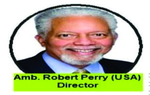
“…AMB. Robert Perry is one of the Directors and a retired US diplomate board of Director USA…”
AMB. ROBERT PERRY
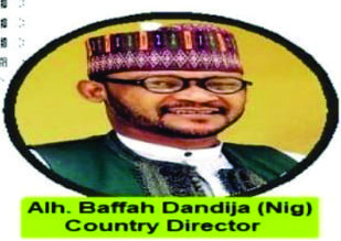
“…Alh. Baffah Dandija is one the Directors from Nigerian…”
ALH. BAFFAH DANDIJA

Dr. Sir Joe Madu is the MD/CEO of Folkan Eye Technology…”
DR. Sir JOE MADU
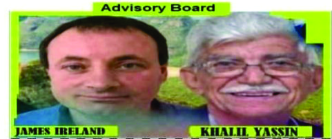
“…Advisory board…”
JAMES IRELAND (left) and KHALIL YASSIN (Right)
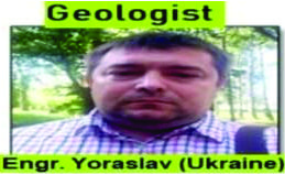
“…Eng. Yorasiav is one of the Geologist from Ukraine…”
Eng. YORASIAV
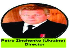
“…Petro Zinchenko is one of the Directors from Ukraine…”
PETRO ZINCHENKO
Let’s explore and mine our unlimited potentials.
visit www.folkaneyetech.com
Folkan Eye Technology are here to help achieve your mining dreams any where in the world as we have directors all around the world.